


Experiential Travel in India: Beyond Sightseeing for International Tourists (2026)
India’s most extraordinary travel experiences are not in its monuments. They are in a weaver’s workshop in Varanasi where a Banarasi silk sari takes three...


 18884507235

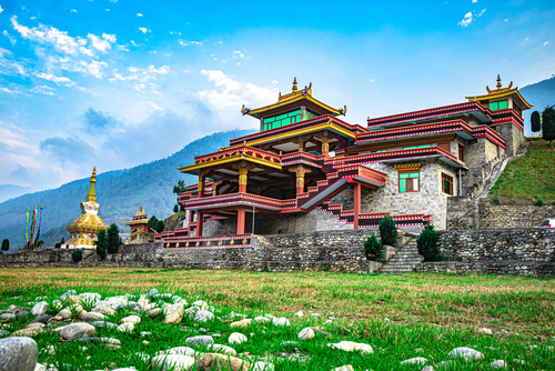
There is a corner of India that most international travelers have never heard of. It does not appear on the standard itinerary. It is not mentioned in the same breath as the Taj Mahal or the Kerala backwaters or the forts of Rajasthan. And yet the travelers who find their way here, who take the flight to Guwahati or Bagdogra instead of Delhi, who cross into the eight states that make up India’s northeastern frontier, consistently describe it as the most extraordinary part of their entire India journey.
Northeast India is eight states connected to the rest of the country by a narrow corridor of land, the Siliguri Corridor, just 22 kilometres wide at its narrowest point, and separated from it by almost everything else: landscape, culture, language, food, facial features, religious tradition, and a way of life that has more in common with Bhutan, Myanmar, and Southeast Asia than with anything in the Indian heartland.
It is India’s most biodiverse region. It is home to the world’s wettest place, the world’s largest river island, and some of the finest living root bridge engineering ever produced by human hands. It has tribal cultures of extraordinary depth and vitality, Buddhist monasteries that rival anything in Ladakh, and wildlife, one-horned rhinoceroses, clouded leopards, golden langurs, hoolock gibbons, that exists in significant numbers nowhere else on earth.
And it receives less than one percent of India’s inbound international tourists.
This is the guide that changes that.
The Northeast is not one place. It is eight distinct states, Assam, Meghalaya, Arunachal Pradesh, Nagaland, Manipur, Mizoram, Tripura, and Sikkim, each with its own geography, its own dominant tribal communities, its own languages and festivals and culinary traditions. Travelling between them is less like moving between Indian states and more like crossing between entirely different cultural worlds that happen to share an administrative region.
For international travelers, four of these states offer the most accessible, most developed, and most rewarding experiences: Assam, Meghalaya, Sikkim, and Arunachal Pradesh. The others, Nagaland, Manipur, Mizoram, and Tripura, are increasingly open to tourism and deeply rewarding for adventurous travelers willing to navigate less developed infrastructure and more complex permit requirements.
A note on permits: foreign nationals require a Protected Area Permit (PAP) or Restricted Area Permit (RAP) to visit several northeastern states, including Arunachal Pradesh, Manipur, Mizoram, and Nagaland. These are obtainable through registered tour operators and the relevant state government offices, but require advance planning. Assam, Meghalaya, and Sikkim do not require special permits for most foreign nationals beyond the standard Indian visa.
Assam is where most travelers enter the Northeast, through Lokpriya Gopinath Bordoloi International Airport in Guwahati, the region’s largest city and its commercial and transport hub. It is the state that most people know by name, primarily through its tea: Assam tea, grown on over 800 estates across the Brahmaputra Valley, produces the strong, malty, copper-coloured brew that forms the base of most of the world’s breakfast tea blends.
But Assam is far more than its tea. It is the landscape of the Brahmaputra, one of the great rivers of Asia, so wide in places that the far bank is not visible, its floodplains creating a mosaic of forest and grassland and wetland that supports one of the most extraordinary concentrations of wildlife in South Asia.
No visit to Assam is complete without Kaziranga, and no description of Kaziranga adequately prepares you for it. The park, a UNESCO World Heritage Site on the southern bank of the Brahmaputra, is home to two-thirds of the world’s entire population of Indian one-horned rhinoceroses: over 2,600 animals moving through tall elephant grass on a floodplain that, during the monsoon, partially submerges and forces the wildlife onto higher ground in concentrations that make game drives of extraordinary intensity.
The elephant-back safari at Kaziranga, conducted in the early morning, when the grass is still wet with dew and the Himalayan foothills are visible on the northern horizon, is unlike any wildlife experience in India. Four passengers on the back of a trained elephant, moving through grass taller than the elephant itself, emerging into clearings where rhinoceroses graze 15 metres away with complete indifference, and where the occasional tiger footprint in the mud tells you that the grass conceals more than it reveals.
Kaziranga also has the highest density of tigers of any protected area in the world, a fact that surprises most visitors who associate tiger safaris exclusively with Rajasthan and Madhya Pradesh. The tigers here are rarely seen from safari vehicles, hidden in the tall grass that provides the rhinoceroses with their habitat, but their presence is felt in every track and pugmark on the jeep trails.
The tea estates of upper Assam, concentrated around the towns of Jorhat, Dibrugarh, and Tinsukia, offer one of the most distinctive and most underrated heritage travel experiences in India. The great tea gardens here were established by the British in the 19th century, and many of the colonial-era bungalows that housed the estate managers have been converted into boutique heritage accommodations, wide verandahs, ceiling fans, servants’ bells still mounted on the walls, and outside the windows an unbroken carpet of tea bushes extending to the treeline.
Staying in a tea garden bungalow, walking the estate in the early morning when the pluckers move through the rows with their baskets, watching the leaves being processed in the factory, withered, rolled, oxidised, dried, and then drinking the finished tea at breakfast from the same bushes you watched being harvested is one of the most complete and most quietly extraordinary farm-to-cup experiences available anywhere in the world.
In the middle of the Brahmaputra, accessible by ferry from Jorhat, lies Majuli, the world’s largest river island, 880 square kilometres of fertile floodplain home to the Mishing tribal community and to a cluster of Vaishnavite monasteries (satras) that have been the centre of Assamese cultural and religious life since the 15th century.
The satras of Majuli, founded by the great saint-scholar Srimanta Shankardev, are living religious communities where monks practise classical Assamese dance, music, and drama forms that have been transmitted in an unbroken lineage for 600 years. The Raas festival, held on the full moon of November, brings the island alive with classical performances that last through the night, a cultural experience of extraordinary depth and beauty that almost no international visitor has ever witnessed.
Majuli is also quietly disappearing. The Brahmaputra’s annual flooding erodes the island’s banks, it has lost over half its area in the past century, and the combination of cultural richness and ecological fragility gives the place a particular poignancy that stays with visitors long after they have left.
Meghalaya, literally “dwelling of clouds” in Sanskrit, is perhaps the most immediately striking of the northeastern states for international visitors. Its landscape is unlike anything else in India: rolling green hills dropping dramatically into deep river gorges, clouds moving through the valleys below the road at eye level, waterfalls appearing around every bend in numbers and scale that the Western Ghats cannot match, and a cleanliness and order to the towns and villages that surprises visitors who arrive with India’s more chaotic urban environments fresh in their memory.
The people of Meghalaya, primarily the Khasi, Jaintia, and Garo communities, are among the most distinctive in India. They are matrilineal: property and family name pass through the mother’s line, and the youngest daughter traditionally inherits the family home. The state is predominantly Christian, converted by Welsh missionaries in the 19th century, which gives Meghalaya’s towns a character that is unlike any other part of India: churches alongside traditional community houses, Western pop music alongside ancient folk traditions, Sunday services attended with the same seriousness as harvest festivals.
The living root bridges of the Khasi Hills are Meghalaya’s most famous and most extraordinary attraction, and they are more remarkable in person than any photograph conveys.
The Ficus elastica, the Indian rubber tree, produces aerial roots from its trunk and branches that, when guided and trained over years and decades, will grow across streams and gorges and take root on the opposite bank, creating bridges of living wood that strengthen with age rather than weakening. The Khasi people of the Cherrapunji and Mawlynnong areas have been training these bridges for generations, some of them for 500 years. The oldest and strongest are capable of supporting the weight of 50 people simultaneously.
The most famous is the Umshiang Double Decker Root Bridge near Cherrapunji, two bridges growing one above the other, the lower one accessible by a descent of over 3,000 steps into a river gorge of extraordinary beauty. The walk down takes approximately 45 minutes. The walk back up takes longer. At the bottom, the bridge spans a clear, fast river in a gorge so green and so quiet that it feels genuinely prehistoric.
The village of Mawlynnong, named Asia’s Cleanest Village by a travel magazine in 2003 and still carrying that reputation with visible pride, has a single-decker root bridge accessible without the descent into a deep gorge, making it a more accessible introduction to the tradition. The village itself, with its bamboo dustbins and swept pathways and flower-lined lanes, is a model of community pride and sustainable living that has become a touchstone for responsible tourism advocates across India.
Cherrapunji, known locally as Sohra, and the nearby village of Mawsynram compete for the distinction of being the wettest place on earth, receiving between 11,000 and 12,000 millimetres of rainfall annually during the monsoon. The landscape this rainfall produces, waterfalls of immense scale, rivers running crystal clear through limestone gorges, valleys so green they seem to generate their own light, is best seen between June and September when the water is at its most dramatic, and between October and February when the skies clear and the views extend across the plains of Bangladesh far below.
The Nohkalikai Falls near Cherrapunji, plunging 340 metres into a pool of implausible turquoise at the base of a cliff, is the tallest plunge waterfall in India and one of the most visually dramatic in Asia. The Mawsmai Caves, a system of limestone caves accessible by a short walk from the main road, give a geological dimension to Meghalaya’s already extraordinary landscape.
Meghalaya’s capital, Shillong, was the capital of the entire northeastern region during the British colonial period, a hill station at 1,500 metres that the British developed as a retreat from the heat of the plains, earning it the nickname “Scotland of the East” for its rolling green hills and temperate climate.
Today Shillong is a city of particular cultural energy, it has produced a disproportionate number of India’s finest rock musicians, and the city’s love of music (particularly guitar-based rock and jazz) is immediately apparent in its cafe culture, its live music venues, and the buskers who appear on its streets on weekend evenings. The Police Bazaar area is the commercial heart of the city; the Ward’s Lake and Lady Hydari Park offer quieter, colonial-era respite; and the Don Bosco Museum, seven floors of tribal culture, art, history, and natural history housed in a striking modern building, is one of the finest ethnographic museums in India and essential viewing before venturing into the surrounding tribal areas.
Sikkim is India’s smallest state by area and one of its most dramatically beautiful. Wedged between Nepal to the west, Tibet to the north, and Bhutan to the east, it is a Himalayan kingdom; former kingdom, technically, having been incorporated into India in 1975, whose landscape rises from subtropical forests at 300 metres to the summit of Kangchenjunga at 8,586 metres, the third highest mountain on earth, visible from Gangtok on clear mornings with a clarity that stops people mid-sentence.
Sikkim is India’s first fully organic state, a designation it achieved in 2016 after converting its entire agricultural land to organic farming over a decade. This commitment to ecological responsibility is visible throughout the state: in the cleanliness of its towns, the health of its forests, and the quality of its produce.
The dominant cultural tradition is Tibetan Buddhism, brought here by the Lepcha and Bhutia communities whose kingdoms predated the formal Chogyal (king) dynasty. Monasteries, gompas, perch on ridgelines and hilltops throughout the state, their prayer flags visible from the roads below, their butter lamps burning through the night in devotion to traditions that connect Sikkim’s mountains to the wider Himalayan Buddhist world.
Sikkim’s capital sits on a ridgeline at 1,650 metres, its buildings terraced up the hillside in a way that makes every rooftop a viewpoint. On clear days, most common between October and December and again between February and April, Kangchenjunga is visible from the city in its full scale, the summit so high and so close that it seems to belong to a different atmosphere from the one you are standing in.
The Rumtek Monastery, 24 kilometres from Gangtok, the seat of the Kagyu school of Tibetan Buddhism outside Tibet, is one of the most significant Buddhist monasteries in the Himalayan world, housing religious treasures brought from Tibet after the Chinese occupation and serving as the seat of the Karmapa lineage whose succession has been a subject of considerable religious and political complexity for decades.
The Namgyal Institute of Tibetology in Gangtok, founded in 1958 with the personal support of the Dalai Lama, houses one of the most significant collections of Tibetan Buddhist manuscripts, thangkas, and ritual objects outside Tibet, presented in a museum of surprising depth and accessibility.
The road north from Gangtok climbs through rhododendron forests, spectacular in March and April when the flowers are at their peak, into increasingly alpine terrain, reaching the Yumthang Valley at 3,564 metres and, for those with the permits and the weather, the Gurudongmar Lake at 5,183 metres one of the highest lakes in the world, sacred to both Buddhists and Hindus, its shores lined with prayer flags and its waters a deep, wind-ruffled blue that reflects the peaks surrounding it.
North Sikkim requires a permit (Inner Line Permit) for foreign nationals, arranged through a registered local operator. The road is motorable from April to November, weather permitting. The journey itself through valleys that see very few tourists, past waterfalls and glacial rivers and villages of extraordinary remoteness is as rewarding as any specific destination along it.
Arunachal Pradesh; the Land of the Dawn-Lit Mountains, is India’s largest northeastern state and its most remote. Bordering Tibet, Bhutan, Myanmar, and China, it is a state of dramatic Himalayan terrain, ancient Buddhist monasteries, and tribal communities of extraordinary diversity, 26 major tribes and over 100 sub-tribes, each with distinct languages, traditions, and cultural identities.
Foreign nationals require a Protected Area Permit (PAP) to enter Arunachal Pradesh, obtainable through a registered tour operator. The permit requirement reflects the state’s sensitivity as a border region; the Line of Actual Control between India and China runs along its northern boundary, and the desire to manage tourism in ways that protect both security and cultural integrity.
The primary destination for international visitors to Arunachal Pradesh is Tawang, a high-altitude town at 3,048 metres in the westernmost part of the state, close to the Bhutan border and just below the McMahon Line that forms the disputed boundary with Tibet.
The Tawang Monastery, founded in 1681, the largest monastery in India and the second largest in the world after the Potala Palace in Lhasa, sits on a hilltop above the town with views of the surrounding Himalayan ranges that extend in every direction as far as the eye reaches. It houses over 400 monks, a library of significant Buddhist manuscripts, and a collection of thangkas and religious objects of historical importance.
The road to Tawang from Guwahati, crossing the Sela Pass at 4,170 metres, one of the highest motorable passes in India, is a journey of extraordinary visual drama: from the subtropical forests of the Assam plains into increasingly alpine terrain, past glacial lakes and snowfields and the sudden panoramas that high mountain passes produce when you crest them and the view changes entirely in a single step.
Nagaland is a state of extraordinary tribal cultural richness, home to 16 major Naga tribes, each with its own distinct language, warrior tradition, and craft heritage, that has become increasingly accessible to international visitors over the past decade.
The Hornbill Festival, held annually in the first week of December at the Kisama Heritage Village near Kohima, is Nagaland’s most significant cultural event for international visitors, ten days of tribal dance, music, craft, food, and sporting competitions that bring all 16 Naga tribes together in a celebration of cultural identity that is simultaneously ancient and entirely contemporary. It is one of the most visually extraordinary festivals in India, the warriors’ headdresses of hornbill feathers and the body tattoos and the ceremonial weapons and the dances performed to drumbeats that carry for miles, and it has developed over the past decade into a genuinely world-class cultural event that rewards the logistics required to attend it.
Guwahati (Assam) is the primary gateway to the Northeast, with direct flights from Delhi, Kolkata, Mumbai, and several other Indian cities. Flight time from Delhi is approximately 2 hours.
Bagdogra (West Bengal, close to the Sikkim border) receives flights from Delhi and Kolkata and is the entry point for Sikkim and Darjeeling.
Imphal (Manipur) and Dimapur (Nagaland) receive direct flights from Delhi and Kolkata for travelers targeting the eastern states.
October to April is the optimal window for most of the Northeast, clear skies, pleasant temperatures, and the post-monsoon landscape at its greenest and most photogenic. The exception is the living root bridges of Meghalaya, which are most dramatic during the monsoon (June–September) when the rivers are full and the waterfalls at their most spectacular, though the descents to the bridges become significantly more challenging in wet conditions.
December is the best month for the Hornbill Festival in Nagaland and for Sikkim’s mountain views before the winter cold sets in fully.
March–April is rhododendron season in Sikkim, the hillsides turn red and pink and white from the Himalayan foothills to the treeline.
Assam alone: 5–7 days, combining Kaziranga, a tea estate stay, and Majuli Island.
Meghalaya alone: 4–5 days, covering Shillong, Cherrapunji, the living root bridges, and Mawlynnong.
Sikkim alone: 6–8 days, covering Gangtok, Rumtek, Yumthang Valley, and the high mountain routes.
A combined Northeast circuit: 14–21 days for Assam, Meghalaya, and Sikkim together, with optional extensions into Arunachal Pradesh or Nagaland for longer trips.
The Northeast is having its moment. Domestic air connectivity has expanded significantly over the past three years, new routes connecting the region’s smaller airports to major Indian hubs have made access dramatically easier, and the state governments, particularly Meghalaya and Sikkim, have invested heavily in tourism infrastructure while maintaining the commitment to responsible, low-volume, high-value tourism that keeps the region’s extraordinary natural and cultural heritage intact.
The travelers who come here now, before the mainstream inbound circuits catch up with what the search data is already showing, will experience the Northeast in its most authentic and least commoditised form. The living root bridges without queues. The tea estate bungalows without waiting lists. The Kaziranga rhino safari without the competition for the best vehicles and the best zones.
This is the Northeast India that exists right now. It will not exist in exactly this form for much longer.
Northeast India requires specialist knowledge to navigate well, permits, connectivity, seasonal access, and the logistics of moving between eight distinct states each with their own requirements. At GeTS Holidays, we build bespoke luxury itineraries across the entire northeastern region, combining Assam, Meghalaya, Sikkim, and beyond into journeys that go as deep into this extraordinary part of India as each traveller wants to go. The conversation starts at [www.getsholidays.com].
Last updated July 2026. Permit requirements for northeastern states are subject to change. Always confirm current regulations with your operator before booking.
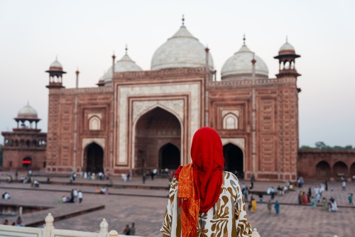
India’s most extraordinary travel experiences are not in its monuments. They are in a weaver’s workshop in Varanasi where a Banarasi silk sari takes three...
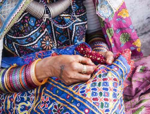
India has more distinct textile and craft traditions than any other country on earth. This is not an approximation. The combination of 28 states, dozens...
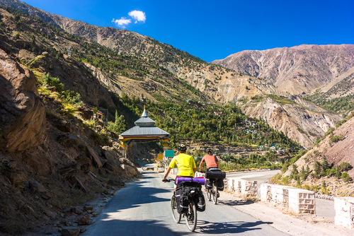
India bookings among adventure travellers surged 214% in the past year. Cycling is at the heart of that surge. International cyclists are discovering that India...
You are one step closer to having the best journey of your lifetime! Talk to us, write to us all that you have envisioned for your India trip, and one of our travel experts will connect with you on priority. To help you explicitly we have WhatsApp and Email addresses!


